
Sunday July 8, 2001
Organiser
Report
Hi everybody,
Here is a report of the Ryuzinkyo trip on the last Sunday, July 8. As you knew, unwanted incident needing to call for help happened at the very end of the walk in this trip. I try to describe what we did and what happened based on facts and analyze the causes of the incident wishing that such a thing will never happen.
Therefore, there is no intention to blame someone here (I know I am the no.1 to be blamed). I simplly wish this report will be productive.
Actual summary of the trip is as follows (Since some of the time records may not be accurate, please let us know if you have more accurate records such time stamps of digital camera images).
7:25
Cars left the 7-11 store.
7:50
Cars left the AIST campus.
9:35
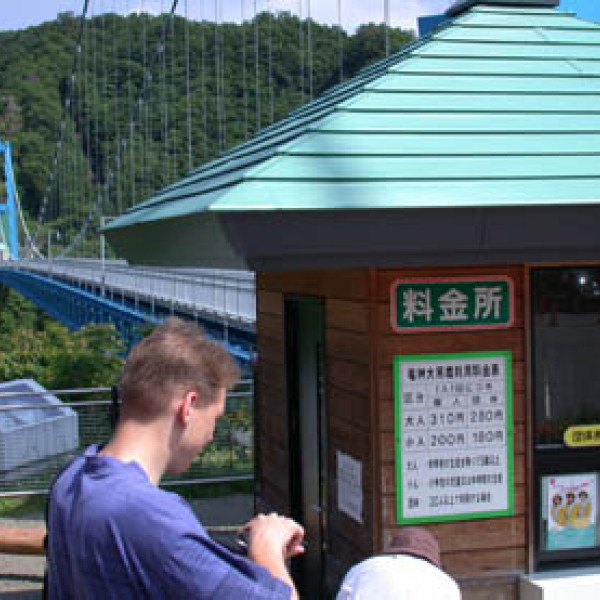
Cars arrived at Ryuzin Suspension Bridge.
People except 3 drivers started walking
10:15
Cars arrived at Nakatakyu. 2 cars out of 3 were left.
: intended end point of the trail.
10:35?
Car arrived at Furusato-mura.
10:45?
Drivers caught up with the group (on foot from here).
11:05
Arrived at Kamegafuchi till 11:30?
12:30?-?
Lunch
15:45
Arrived at the waterfall at the end of Ryuzin-gawa. (till -16:30)
18:30?
Were at the highest point near the cars but could not find the route.
19:45?
Asked the house wife to deliver our help message to the police.
??
Rescue team arrived at the house.
22:??
Rescue team arrived at our place.
24:00?
Escaped out to the road.
27:00
Cars arrived at Tsukuba.
First of all, I must say that difficulty grading of the walk was greatly underestimated. I did take almost the same route twice about 15 years ago. My memories of the walks were not clear but I remembered clearly that more than half of the participants were high-school students for both trips and I knew one of my collegues were a biginner. Therefore, I thought there existed easy bypath routs although I knew non-bypath routs are rather difficult. I should not have indicated "relatively easy" but I agree that I shoud have graded ***. It was my great mistake.
To cover my unclearness of my momery, I decided to bring an handy GPS (rented from another mountneering club of my institute). After unloading participants at the starting point, Ryuzin Suspension Bridge, drivers (Melissa, Shinji and me) drove their cars to the intended end point of the trail, Nakatakyu. We left Melissa's and my cars there. At this point, I memorized the position by the GPS in order to make us easily come back to our cars.
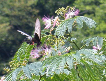
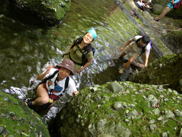
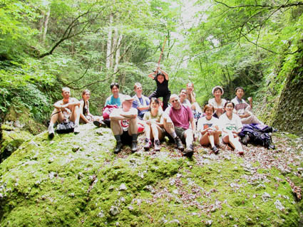
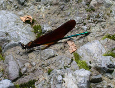
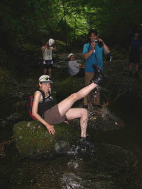
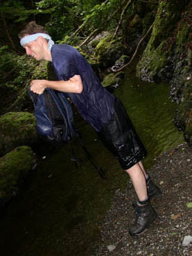
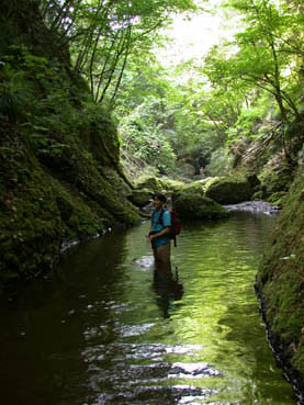
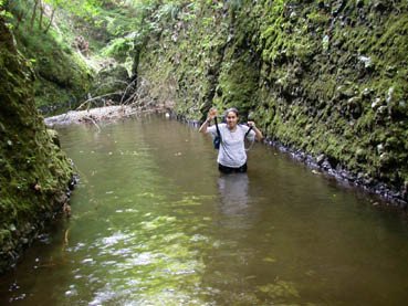
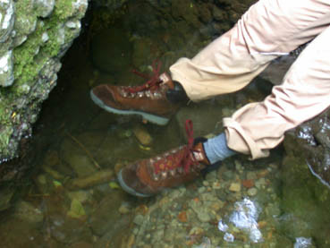
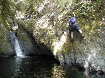
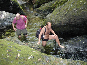
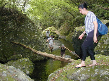
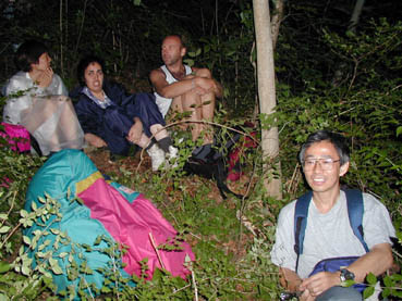
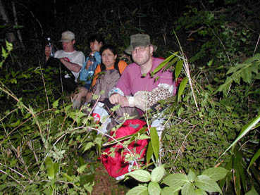
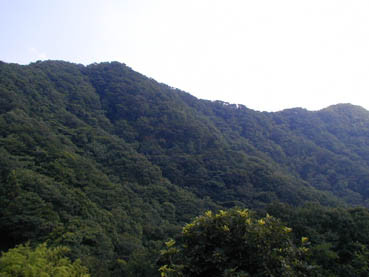
The three drivers went back by Shinji's car to a point inbetween named Ryuzin-Furusato-mura, got off the car and start walking to catch up with the others. Soon after, the drivers easily merged with the others. Real walking started from Kamegafuchi at around 11 am since the waliking until this point was on a paved road. You can get rough image of the walk from the photos posted on the mailing list. If draw a straight line from Kamegafuchi to the waterfall which was the end target of the Ryuzin-gawa, its distance is ony 2.5 km. However, since the river is winding and there are many obstacles it takes much time. It was about 15:45 when we finally arrived at the waterfall.
In spite of my misgrading, the participants succesfully reached the waterfall. Judging from the result, we should not have spent such much time (15:45-16:30) there. Relating to the time schedule, after all we left Tsukuba 50 minutes later than scheduled. This delay could have been shortened too.
Before reaching the waterfall, we saw a red arrow drawn on a rock at an intersection of a branch river. considering its location and direction of the arrow, I took it shows a trail leading to Nakatakyu, our parking place. I checked its location by GPS and marked on a map (1/25000). By looking terrains around us, the location given by GPS seemed reasonably accurate and I confirmed that the branch trail shown by the red arrow suitably leads to our parking space. The GPS showed that the distance to our cars was only 1.3km (in a straight line). Considering tha fact actual trail is winding, I tought at the time we could come back to our cars in about 1 hour or so. However, the reality was not after all! (We were told later, if you do not lost, it takes about 1 hour, same as my guess) After spending a time at the waterfall, we came back to the red arrow and follow the arrow. The arrow is directed to upstream of a branch river but a little tilted to the right. In that direction, there are a series of red piles/ red paints, which is departing the branch river. We followed the series of red piles. After all, we were told later red piles does not show a trail but merely show the border between a national forest and private forest! Anyway, it turned out we could have come back without problem if we had departed from the red piles on a peak.
What we did in reality was to keep follwoing the red piles and started to descend in a very steep slope. There were two reasons why I did not stop descending immediately. The first big reason was that the GPS showed our cars in that direction of the descent although I began wondering if it was really correct from a little before the time. The socond reason was that we saw an isolated private house on our right of the descending slope. I knew car road was located east of us on a ridge. The slope went west. Although the direction was opposite, I had a slight expectation that there might be a path leading to the house ahead.
While I was wondering, some preceding walkers went down far ahead. The steepness of the slope was not normal. Rocks were easy to fall down. The distance to the house was becoming farwer. Then I decided to climb up again. It was lucky that I was able to deliver my decision by person to person to all the preceders. Here is another point that we should learn. People should reasonably stick together especially in such a case. I understand the preceders wanted to vollunteer to find a right path for the rest of us but in that case I must say there was a danger that we were not able to communicate any more. I should have orgnized in advance to avoid such risk.
We gathered on a middle point of the slope where the house could be seen from the woods almost at the same level but it seemed hard to reach due to a deep gorge inbetween (we knew later the distance between our place and the house was about 400 m). Luckily, a housewife of the house kindly came out and we were barely able to communicate in a loud voice (it was sad to know my voice did not work. Masako's voice was No.1. Thank you very much for you voice, Masako!) We knew she does not know how to and cannot reach our place. I wanted to know the location of the car road but the communication was not succesful.
The sun was setting soon. I still had a hope to reach our car if we climbed up. I asked people to stay there and then Victor and I started climb and tried to find a path to the house or to the road. We could not find a path to the house. Soon after, we decided to call for help through the lady.
Shiji had a mobile phone. He thought first the area was out of range but suddenly knew it was available! Therefore, he also made a phone call for help to the police. I cannot remember when first rescue team arrived at the house. Finally they came to us by traversing the gorge. After asking questions, we were aligned in an order of man after woman and rescue members were distributed among us to guide us to walk. The rescue team guided us to the exit of the forest by taking a different roue from the rescue team took. We climbed up to the peak and diversed from the red piles.
Finally, we were escaped from the woods and welcomed by a huge crowd of people, ambulance cars, and police cars. We knew later village mayors wife was serving tea to us. It turned later that the place was very close to our cars.
I am really relieved to know nobody got panicked, had positive minded- light mood atomosphere and shared foods and water in a difficult situation. I greatly appreciate cooperation of our companies.
Terry
P. S.
I still have something to tell you about GPS.
I will post it later.
(Terry's second report below)
Hi everybody,
This is a second part of the Ryuzinkyo trip report.
You might say that the participants in this trip was mislead by the leader, me. And, I was mislead (confused!) partly by the GPS, I would say....
After checking the records of GPS and revisiting the places (when we did thank-you tour), I was able to plot our actual trace at the end of the walk and found out a problem of the GPS (system). You can see our actual trace (shown by a red line) on the map at the site below: http://www.geocities.com/terrysaito/Ryuzinkyo/Okuryuzin.jpg
Specification of the GPS (Magellan GPS 315) says;
Position accuracy: 15 meters RMS (with Selective Availability turned off).
Selective Availability is an error intentionally introduced for public use by American Department of Defence (DoD). I think the DoD decided to stop using Selective Availability several years ago. Therefore, accuracy for public use is as good as for military use. It was my understanding about the GPS system at the trip and I think still it is correct.
However, hard to belive, what really happened when I marked the position of my car (and Melissa's car. Marked by a blue point on the right on the map) was that the GPS reading of its location was falsely located (marked by a left blue point) west of the actual poit by 1 km! I still have an evidence of the records with its time stamp in the GPS. I memerized the location twice for safety. Both records are exactly the same except for the time stamp and they read:
latitude: 36-42-43 N
longitude: 140-26-27 E
elevation: 1320 m
time: 10:14:44am 08Jul01
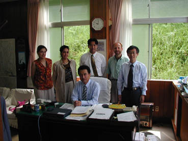
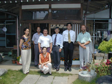
Three days later after the trip, I and some other represetatives did a thank-you tour and we visited the same place again. I brought the same GPS and marked the same place again. The reading was as shown below and it exactly matched the location of the map.
latitude: 36-42-49 N
longitude: 140-26-56 E
elevation: 477 m
time: 01:57:51pm 11Jul01
Note the difference not only of latitude & longitude but also of elevation. At the false location, there is no terrain with such high elevation, and no road. Therefore, it is clear that the GPS reading at the time on Sunday had a exceptionally significant error in location.
There was a supporting evidence/witness about this. It was about 5 minutes before I marked the point on 8 th, Sunday. Since we were not sure about the place where we should park, I checked the location by Shinji's car GPS navigation system. The display showed his car trace on a map. We were a bit surprised to see that the car trace was not on the road but deviated to the west very much (somewhere between the road and Ryuzingawa).
Therefore, it is highly likely the position error was not caused by the receivers themselves but by the satelite signal condition and/or some special environmental condition (such as reflection?). In principle, error can be large when number of catched satelites is not many and all the satelites are located in a close direction. I knew later after reading the user manual that the GPS shows estimated position error. However, it is only shown for a little while when the receiver succesfully catch enough number of satelites and there is no record for it. Therefore, we cannot know how big the error at the time was. Usually, the position error reads surprisingly small such as less than 10 m.
Wise readers may say that we should have noticed the misreading when two GPS showed such similar behaviors. However, I did not notice anything strange about my handy GPS at the time. Now, I can say I should have paid attention on the GPS location information such as elevation and/or checked its proper operation by verifying its location on a map.
In addition to such happening of unusual misreading, I would like to tell you one other important point about the use of GPS. It is a setting of map datum. I knew a little bit about this. I thought it was ok because in the very first use of the GPS, an intialization screen came out and it asked about the area of the user. Therefore, I thought an appropriate map datum was automatically chosen. However, I have known it was not! I have known this because when we revisted the places, all the location given by the GPS were displaced to the northwest by 500 m compared to the map location. It turns out that world-wide map datum, WGS84, was used. By switching to Tokyo datum, the position information in the GPS memories matched exactly to the map location. Of course, the GPS should have been set so earlier.
However, this setting does not affect so-called "Goto" function which was used for coming back to our cars at the trip because the function is kind of relative within the system based on its own reference and does not refer to outer world location reference such as latitude and longitude of a map.
We have learned a lot through this experience. In addition to the preveous report, let me add a little. We were lost in the area where the highest elevation is only 560 m. Therefore, don't judge difficulty simply from the elevation. We were lost at a point where the nearest house is only 250 m apart and the nearest car road is only 200 m apart and had to stay after sunset. Therefore, observe the instruction about what to bring such as a flashlight. As for GPS, although we still cannot assign a true cause of such big position error, we knew such big position error can happen. Therefore, we should keep in mind about this possibility and always excute double check. If we observe this, I think a GPS is really useful.
Terry
Added in proof.
: This value (250 m) is more accurate thatn the value of 400m found in the last report.