Saturday September 14, 2019
Details
This is the first announcement for Ozaku-san hike (石裂山)for 2019/9/14(Saturday). This hike was originally planned last September but it was cancelled due to weather condition.
I would like to proceed again the day-hike this September because I think it is still worthwhile to introduce many hikers to such a nice local but relatively unknown mountain.
I put forward the same information regarding this hike again as I did last September.
Destination: Ozaku-San
Height: 879.4m
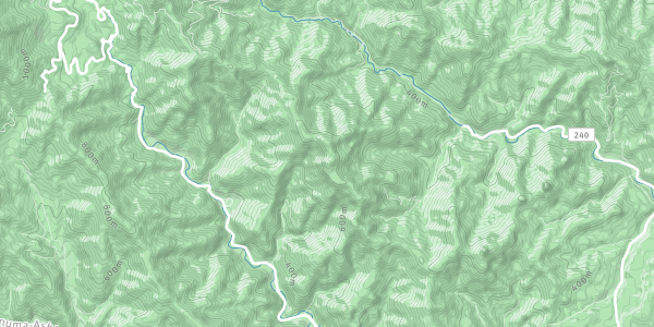
Location: Tochigi-ken,Kanuma-city
Date: 9/14 (Saturday)
Meeting point: Tsukuba TX station car park
Time: 6:30am
Transportation: car
This is the car-basis trip to Ozaku-San.
My car allows maximum 4 participants to have a ride,preferably 3 people excluding the driver.....me!
I appreciate very much if any participant could join with a car if participants are more than 4 people.
The schedule:
6:30(Tsukuba)—-> (zyoban line)—>(Higashi-kanto line)—> Toga Exit —>route177–>route240–> Kaso-San shrine (the driving time would be around 2h).
Kaso-San shrine —> one of local onsen —>motorway (which route we are taking is dependent on which route is less crowed ...)
—> Tsukuba (Target time is 20:00..)
The brief information regarding this mountain:
Kaso-San shrine which is laid as the gateway to Ozaku-San was opened up by Syo-do holly priest who pioneered the Nikko shrine in AD782.
The route to the summit is formed with steep ascend with many chains and metal ladders along the mixture of trees and rocks. But,it is not the same as Myogi-San in terms of difficulty level (easier than M...).
The one of the peaks called Tsuki-Yama is the best spot,where you can see the nice figures of several peaks of Nikko mountains (Nantai,Oku-shirane....).
@@The difficulty level ## 3/5 ##
The time to complete the route (with return)is roughly estimated around 4h.
There are some pics on the way to the top as below.
https://4travel.jp/travelogue/10882139
Regarding the weather factor, again the hike will be cancelled in case it is getting wet. The sloppy rocks and wet metal ladders are nothing but very slippery element for this hike. Hopefully we could ascend the peak this time....................
What to bring and what to put on:
Good boats
Cool clothes (like T shirts)+ warm clothes
Rain gear
Lunch
Water
Gloves (to handle metal chains .....if you need.)
Onsen stuff
Organiser

Report
Many many thanks to all participants for having been able to share the great time in this hiking event, Ozaku-san hike.
This hike event was originally designed in the schedule of autumn, 2018. However, I had to cancel twice unfortunately due to miserable weather and my personal issue. Therefore, I am now very pleased to have been able to complete finally this day-hike event with such enthusiastic hikers from various nationalities despite the fact that it was cloudy and a bit wet condition.
We left the carpark of Tsukuba TX station around 6:40~ and stopped over for the short break at the local SA along route 3 beside Tsuga motorway exit (along Higashi-Kanto expressway). We arrived at the carpark of Kaso-san shrine using route 3, 177, 240 and 280, that is the gateway to Ozaku-san around 9:15~.
The path was initially elevated gradually until we got the small resting facility, Ryugataki-kyukeisyo. Soon after we came to the junction which was divided by the step narrow valley with dense ever-green forest. Our choice at this occasion was the left path (heading along the route clockwise.). The narrow and steep path turned out to be zigzag trail on the bit rocky ridge with trees and subsequently we were obliged to support ourselves with several metal aiding systems such as ladders and chains.
After walking over the steep path and continuing our walk on the relatively wide trekking route, we got the non-impressive peak called Nishi-kennomine(11:40~).
From there, there went twice up and down work-out along long metal ladders, leading to the summit of Ozaku-san(13:00~). There was no visibility from the top and kept walking until the another point called Gassan (Tsuki-yama: Moom-montain: 13:17~). That was the end of ascending along this clockwise way of the route. The descending from Gassan was not very fun because the route was formed with full of wet pebbles (slippery!) along steep slope also with many fallen trees. We came back to the same junction and walked down along the same path heading back to the carpark (15:00~).
After the bit physically intensive and strenuous walk was completed, we quickly drove to the local onsen place (Tochigi-tennen-Onsen; Iki-Iki Yume Roman) to wash off our sweat and to fill our stomach.
We came back to Tsukuba TX statin-carpark around 8:00.
Although the weather was not ideal, we had a luck to avoid the worst condition with rain throughout our walk.
I enjoyed this hike very much with those who are enthusiastic hikers and again I must express many appreciations to all participants (Andreas, Anja, Eshmael, Sakiko and Thierry! In particular, Thierry for his great help to bring his car for this hike ).
Location