Saturday February 10, 2024
Details
This is the second update of the Nokogiriyama hike on Saturday, Feb 10.
The weather outlook is not bad, it is partly cloudy. Considering recent instability, it actually sounds good!
Here are the registered participants. We could do with one more car. Car owners may please consider joining. It's going to be fun!
Alok (car, 4)
Archana
Anna
Anja
Nathan
Yunosuke (car, 3)
Ken
Matt
Rie
Among the first hikes this year is to Nokogiriyama in Chiba, along the Tokyo Bay coast and a view of the Pacific ocean. It is only about 330 m high, and a very interesting place to visit (I could just mention that it even has a ropeway).
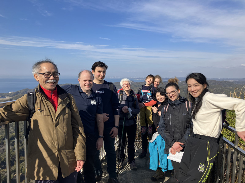
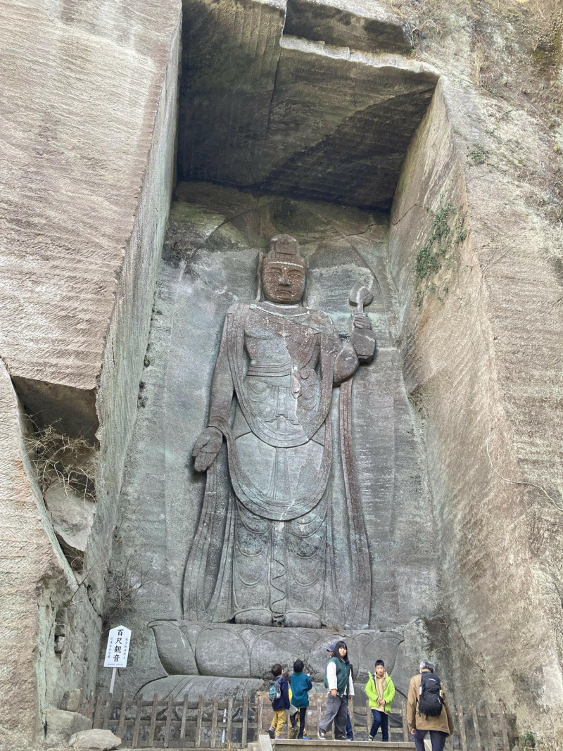
The mountain has a peculiar saw tooth shape due to stone quarrying during the Edo period. There are interesting shapes along the hiking trail, a large Buddha carved out on the side and a large Buddha (Daibutsu) statue carved out of stone near the top.
There is more information here:
https://www.visitchiba.jp/things/mt-nokogiri-hiking-trail-guide/
https://tokyocheapo.com/entertainment/outdoors/view-nokogiriyama-hiking-chiba/
We depart Tsukuba at 6:30 AM. From the Tsukuba center parking (drop-off/pick-up parking, free for 20 min.)
It is a car based trip, taking the Ken-O expressway towards Narita (avoiding Tokyo) to minimize any traffic delays. It should take about two hours to reach.
Tsukuba --[Ken-O]--> Takei JCT ---> Miyanoki JCT ---> Futtsu-Kanaya IC exit. Highway toll will cost about 3580 yen each way with ETC.
What to bring: Your breakfast and lunch, water, etc.
What to wear: Hiking boots, clothes according to the weather.
Club fee 300 yen as usual.
Organiser

Report
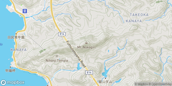
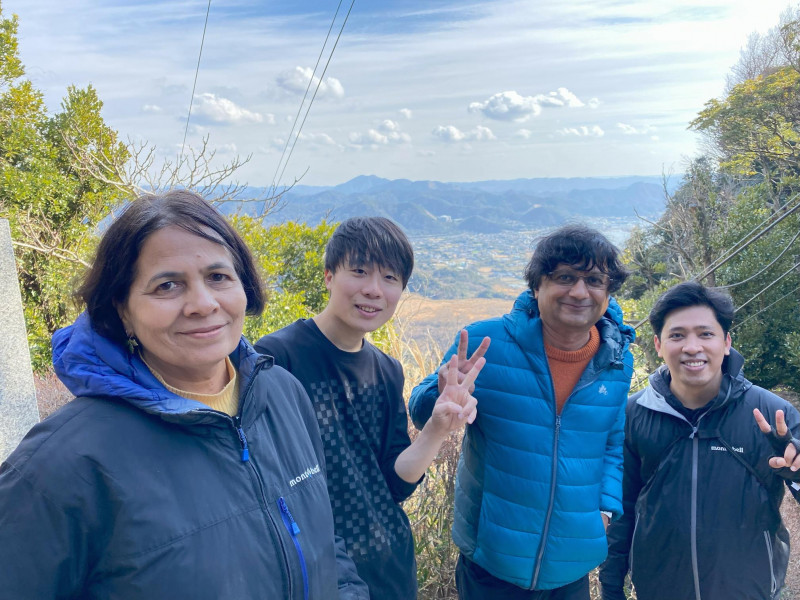
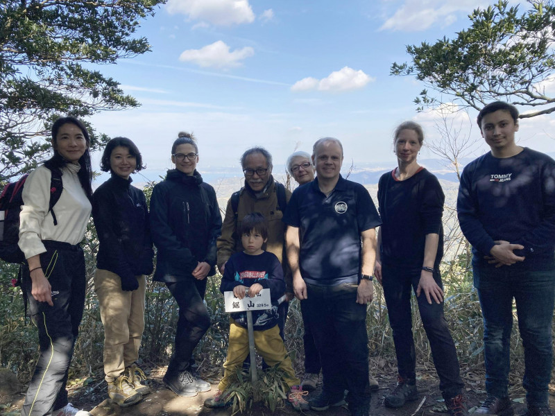
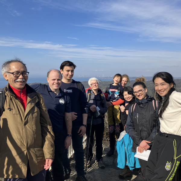
13 participants (including a 6 years old) departed in three cars on a hike to Nokogiri yama in Chiba on 10th February and came back the same day after an eventful day.
We departed soon after 6:30 AM from Tsukuba center and took the following highway route
Tsukuba Ushiku --[Ken-O]--> Takei JCT ---> Miyanoki JCT ---> Futtsu-Kanaya IC exit. Highway toll each way cost 3,450 yen (~150 km, after holiday discount). We stopped at a parking area after Narita, and then a service area in Ichihara.
We arrived at Hamakanaya train station by about 10:00 AM, but parking is not allowed there now. A local volunteer suggested that we can park free of cost at the harbor, if we could still find space. We didn't want to spend time trying that. We instead went to Tourist Information office Ishinoya and parked in a private parking for Yen 800 per car.
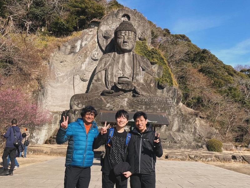
It was over 10:30 by the time we started walking. All of us took the Shariki-michi trail (instead of Fureai (nature) trail). It was indeed a historical and wide trail, easier for going up to the peak of the mountain (~330 m), towards the east side of the mountain. However, it did not connect well to the Nihonji temple complex on the west side, where we had to go next. There was a trail which went a bit down to the Fureai trail and then up to the Nihonji temple complex (east gate). There is an entry fee of 700 Yen to the temple complex.
From the beginning we became grouped in three or four groups. We were all tired by the time we came to the west end of the temple complex, and it was barely 3:00 PM. The last ropeway trip (which runs every 10 min.) down was at 4:00 PM. Many of us gave up on going down on the other side of the mountain to visit the Big Buddha (~30 m tall). Instead, we all took the ropeway down at about 3:30 PM. It was another short hike of a rugged trail to the ropeway station. Except one group, which went down but did not come up. Instead, they walked to Hota station to take a train back to Hamakanaya (this train runs once every hour, but they could make it in time to catch the immediate train).
Even though the height of the mountain is low, we invariably seems to have taken the ropeway back, right from the first time in 1998 as John (a founder of the club) reports ( https://www.twmc.club/activities/1998/nokogiriyama ). He found it more tiring than climbing a large mountain. I cannot find my own report of the 2012 hike (organized with Dragan [pages of a few years of about this time are missing on our webpage]) but I am quite sure that we took the ropeway down.
My original plan seems to have been better: (i) only a few may try the peak, for which the Shariki-michi trail is better. (ii) Most or all may take Fureai nature trail, which leads straight to the east entrance of the Nihonji temple complex. There is enough to see within this complex, including climbing on to the ridge of the mountain for the Hell-view. And, of course, down below on the other side to the Big Buddha (Dai Butsu). This will save time and energy to do all interesting things. (iii) Plan from the beginning that all will come down by ropeway (last at 4:00 PM).
We started back in our cars at about 5:15 PM, and stopped at service area Ichihara to spend some time together, have something to eat and drink, and do the accounts (for transportation).
It was a very enjoyable and exciting hike. There pictures by some of the participants in this album:
https://photos.app.goo.gl/grs2gqHDUHWiufEk6
see you on next hike,
Location