Saturday June 30, 2012
Details
Tanzawa hike is a medium difficulty, circular hike that takes us up to Tonodake (塔ノ岳, 1491m). Most of the trail is along ridge lines so weather permitting we should get great views. Access will be by train and we will stay at a mountain lodge.
Meeting point: Sat 30 June 05:20hrs
Tsukuba Express station downstairs on the benches next to Starbucks.
Access:
05:32 TX Tsukuba->Kita senju 06:13
06:24 Chiyoda Kita senju->Yoyogiuehara 06:59
7:06 Odakyu Odawarra Yoyogiuehara->Shibusawa Arrival; 08:16
Total cost: 1880円
Route
From Shibusawa station we need to get to the trail head next to Donguri mountain hut (どんぐり山荘). This is approximately 2-2.5Km walking roughly NNW on flat ground beside rice fields.
The fun starts at Donguri mountain hut. We walk directly along the ridge line up to Minoto (三ノ塔,Triple pagoda).
This is an ascent of approximately 700m with a map time of 3hours.
Map times frequently assume that either you or your walking frame have a broken leg, but even so we will have earned lunch by the top.
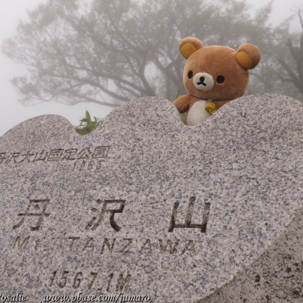
From Minoto most of the climbing is done and we can enjoy walking NW along the ride to Tonodake (ascent about 300m, map time.2.5 hrs) where we stay at Sunbutsusansou 尊仏山荘.
We should have have time to relax in the late afternoon.
The fit and keen may wish to leave packs there and head north along the ridge to Tanzawa itself (about 1hr each way, ascent 100m).
After breakfast on Sunday morning we make our way south west along the ridge towards Daimaru.(大丸) and (can anyone give the correct reading for this!) 鍋割山。This is level to slightly downhill ridge walking and should be
quite easy; map time 1:10hrs. Weather permitting there should be great views to the west.
At 鍋割山 we turn south and follow the ridge line back down to the plains. This looks like a moderately steep descent.
There is a bit of a loop around the base of the hills which takes up back to the road into Shibusawa station. Map time is about 4hrs from 鍋割山.
From Shibusawa we can take the same train journey in reverse to get back to Tsukuba.
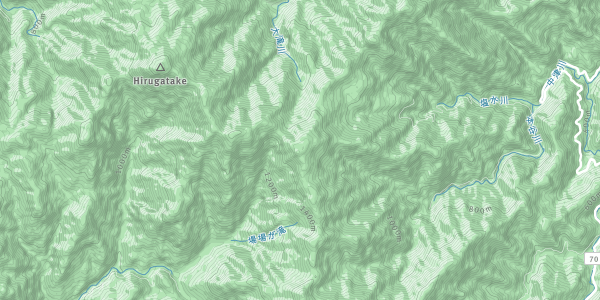
Map
I have made a rough map here; http://goo.gl/maps/xGN8
The resolution does not allow for all the walking paths to be marked, but it should give you an idea.
Options;
1)There are several south-running ridges both before and after the planned course. Depending on time and fitness we can shorten or extend the second days walk to suit.
2) The station 3 up from Shibusawa is Tsurumaki-onsen. Time allowing we can investigate onsen on the return trip.
Equipment:
Boots; worn in mountain boots. The ridge trails can be a bit rough and runners/sneakers will not be adequate.
Sun hat and sunscreen.
Water (1.5-2L, ridge-climbing is thirsty work)
Rain coat
Pack (30L capacity is a rough minimum)
Breakfast (Saturday)
Lunch x2 days
Light, easily digestible food and some snacks,
Torch (preferably head torch)
Onset towel (in case we go to onsen afterwards)
Expenses
Transport 2x 1880 yen 3760円
Accommodation 6000円 (including dinner Sat and B/fast Sunday)
Club fee 1000円
Total 10760円
plus money for any incidentals
Organiser

Report
The Tanzawa hike saw six of us making a loop from Okura up to Tounodake and around to Nabewariyama, with a side trip to Tanzawa on the way.
While it would have been great to have a spell of clear skies, we enjoyed a weekend in the misty forests and mountains.
There were some reasonable steep sections, such as the initial walk up to Sannotou, interspersed with a couple of sharp descents (ladders and chains) and narrow pathways with steep drops on either side. Most of the time was spent climbing on narrow forest trails amongst the clouds. We were lucky to only have a spot or two of rain on Sunday.
For future reference it is worth noting that access to water is limited east of Tounodake.
Location