Saturday June 18, 2016
Details
Cyo-gatake and Jyonen-dake hike are located in the centre of "Omote Ginza" which consists of 4 mountain peaks (others are Tsubakuro and Otensyo) in Northern Alps. The route covering these 4 peaks are of one of the most popular ridge hikes in Northern Alps. Because, firstly, the short accessibility from Matsumoto gains advantages in terms of time and budget and secondly, many view points from the ridge route bring you stunning panorama sights directing Hodaka dake and Yarigadake. Fortunately, we have much less snow this year compared to usual season. Thus, a sort of lightweight gear preparation ( no ice gear) is good enough to pursue walking through this hike route.
The brief schedule for this hike is shown as below;
First day:
Mitsumata(三又)----- 4.5h------Cyo-gatake ---> Cyo-gatake hut
Second day:
Cyo-gatake----1h-----Cyo-kura-----3h----Jyonen-dake----1h-----Mae-jyonen----3h----Mitsumata
Obviously final destination after descending from this hike would be an onsen to heal your muscle-ache if the time schedule allows to do so. The location of the onsen is placed nearby Mitsumata ( Fine view Muroyama) where can provides you with view of Matsmoto plain from Roten-buro( outside onsen).
Our accommodation : Cyo-gatake hut ( 9500yen including 2 meals) The difficulty level: ***
( I have pre-booked for 6-8 people in advance.)
The cost per person for this trip: 18000~22000yen ( car trip from Tsukuba and shared with all participants )
Travel route :
This is a strictly car-basis trip from Tsukuba. There is no way to use JR to adapt the time schedule of this hike unless potential participants could come in the evening of 17th. I will transform this hike completely so as to be able to use public transportation if no car owner is coming to join this hike. Needless to say, it would be my last preference to do it...
All participants from Tsukuba are instructed to set up the schedule from Tsukuba using cars.
As usual, my TWMC trip needs a sub leader who is capable of organizing the car trip from a Tsukuba to the meeting point Mitsumata, Nagano. In case we have difficulty in finding car owner for this trip, we could set up a rent car as we did a couple of times in the past.
As there is a long distance trip from Tsukuba to Mitsumata using car on the first day, leaving Tsukuba in an early morning( around 4:00am) is an essential element to finish off our walk comfortably on 18th.
I will meet up with participants from Tsukuba at Mitsumata car park around 9:00am on 18th.
Currently I am in the middle of rehabilitation from my leg injury and thus the walk schedule may consume a bit longer time than this initial plan. It would be grateful if you could allow me to set up the walk with laid-back style ( not " macho type of running ").
The detail information regarding our route is obtained in HP as below.
http://www.yamareco.com/modules/yamainfo/rtinfo.php?rtid=1453 (in Japanese)
http://www.mountain-forecast.com/peaks/Jonen-Dake ( in English)
What you need to bring:
Good walking boats
Long pants
Gloves
Rain gear
Head touch
Warm clothes
Hut or cap
Snack/emergency food
Lunch ( two lunches)
Drink/ 1.5L of water each day
Onsen stuff( can leave in a car)
Please drop me your email notice including your information as below.
1) car owner for this trip?
2) your name
3) Could you volunteer as a sub leader ??
From my policy I will stop asking for the participation once the number becomes 8 people in this early summer hike around Northern Alps.
Organiser
Report
The hike report( Cyogadake and Jonendake 2016/6/18-19)
Many apologies for my delay in uploading the hike report from Jonen and Cyo hike in Northern Alps.
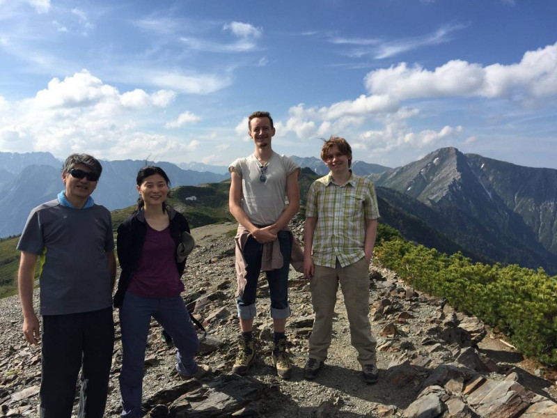
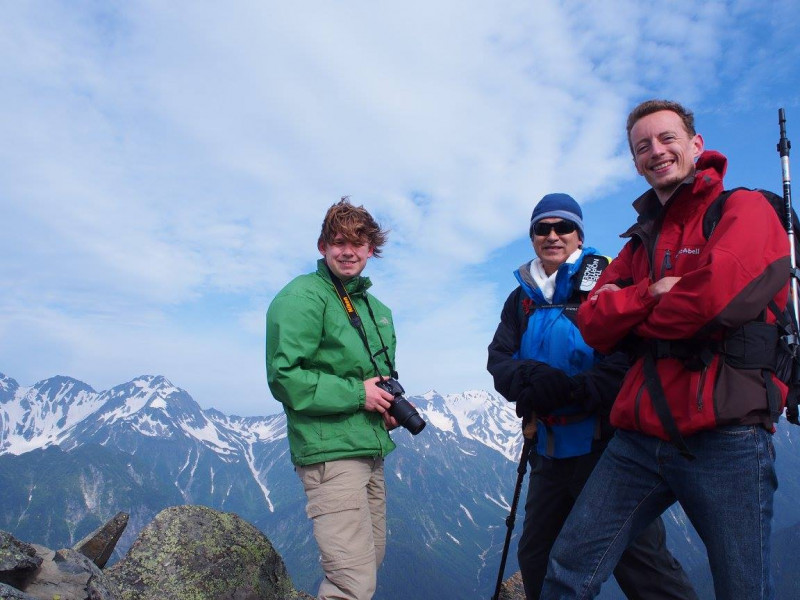
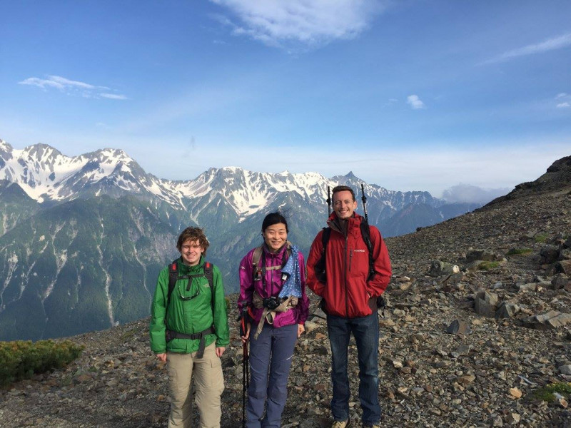
Thanks for your coming to this hike, Kyoko, Thierry and Floris. I think we had a very good time in Northern Alps at the weekend apart from very wet ending.
We had a good weather to start up this weekend hike to "Omote Ginza" of Northern Alps. As scheduled, we joined up at Mitsumata car park at 9:15 but the main car park had been already closely- packed with many cars. Therefore, we ended up to drive down to the second carpark which is located around 1km away from the main carpark.
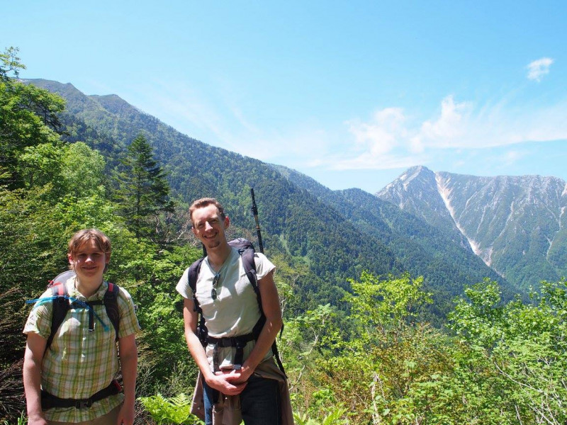
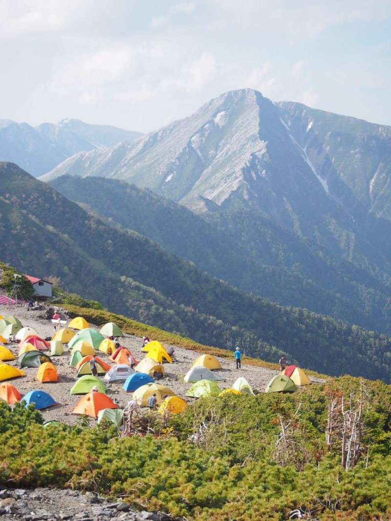
Our hike began at 10:00 after preparation from the carpark( 1300m high) and kept moving forward until lunch time apart from the time to fill in hike plan to drop the mountain post and several short break. We came across the natural wooden statue looking like TRex or "Gozira" on the way up. The path is located inside the wooden forest heading up to Cyogadake. It was rather boring walk with limited sight. The forest walk continued until 2200-2300m high and then visibility to other mountains( Jonendake etc) improved gradually as approaching to the submit. Our arrival to the Cyogadake summit came around 15:00 after enduring walk from Mitsumata carpark.
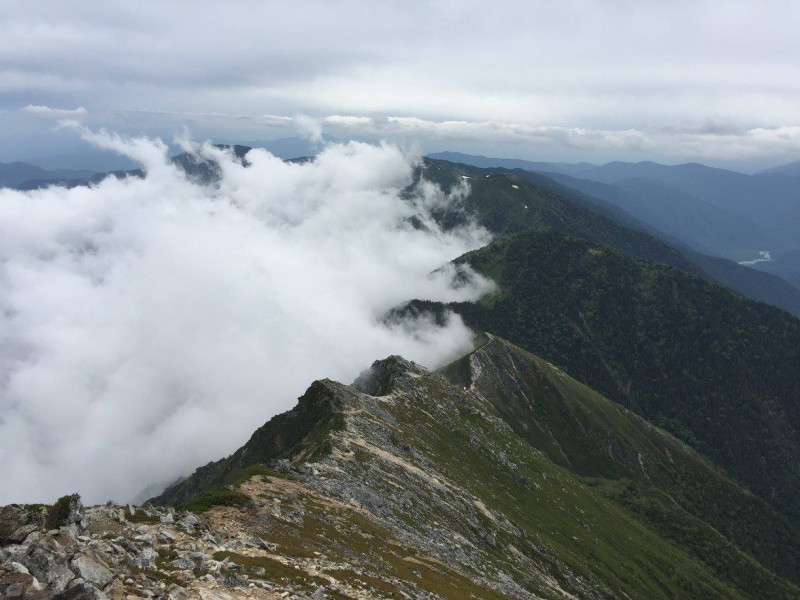
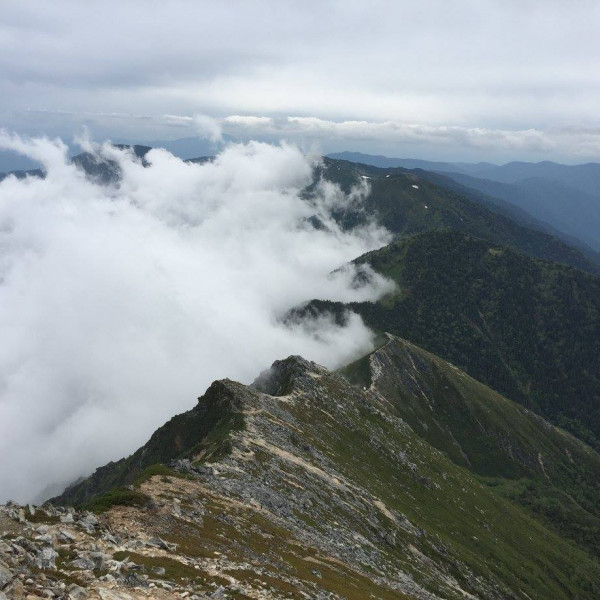
The view from several hills around Cyogadake was stunning particularly regarding the central backbone of Northern Alps from Maehodaka to Yarigadake. These main peaks are more or less assembled into the sequential line from south to north including the famous scrambling route, "Dai- kiretoo" ( Great gap). All peaks and ridges were clearly visible in spite of several patches of clouds above them. Snow patches also came into our sight beneath the ridges ( in particular a large snow path remains in area of Karasawa spot).
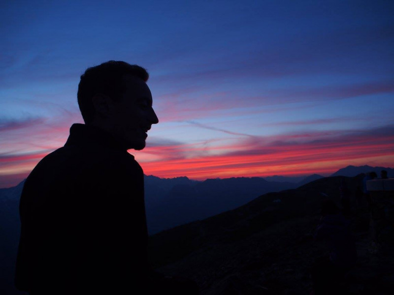
We sat facing these great view on the hill and had a great quiet time with sun and gentle breeze. This was the best moment of this hike. Kyoko, Thierry and Floris were spending their time for photos after having a good dinner whereas I needed my rest for my knee and body-fatigue ( disparity of recovery time between 20s and 60s.....).
Next day we got up around 5:00am and had breakfast 5:30am to leave Cyogadake hut around 7:00am. The second day was to move along the ridge to Jonendake and descend heading to Mitsumata carpark via Maejonen. The Course time was approximately around 8h. However, it ended up to have consumed 10h with being soaking wet from head to toenail due to firstly hard rain in the afternoon and secondly my knee problem.
Our initial hike made a good ground with fine weather ( a bit windy though). The path was solid and firm with clear signpost to introduce those who are heading to Jonendake without any fault one. It took around 4h to get the top of Jonendake through Cyo-yari and we still had a view from the summit.
However, the weather gradually grew thick cloud and got worse by the end of our lunch( 11:30). This change brought us a long march heading to Mitsumata carpark with seamless rainfall until the end of our walk.
By the time of our passing MaeJonen the rain got harder and my realization came to me that it would not burn down as my cloth affinity with massive volume of hydrogen oxide was increasing....
After descending around 2h my knee again started to cry and begging me to slow down.
At the time we were in upper Forest zone on the way down along the muddy path.
Again realizing that my descending speed became a time consuming in this small group, I asked the rest to move ahead to carpark leaving me behind.
After another 2-3h struggle with slippery, muddy and gel-like zigzag path I finally could return to the starting point without any further injury but with dripping wet. On the way down by myself large flogs often came out with "friendly croaking ". I was rather pleased with these amphibian animals compared to unexpected encounter with beer or monkey. Kindly Kyoko-san could come to closest point with her car to pick me up( they got the carpark 30min earlier ...) . After getting out from this wetland ( around 4:45pm) we went straight hastily to Onsen place called "Fineview
Muroyama"
http://www.fineview.co.jp/fineview_spa.html
Again many thanks to Kyoko, Thierry and Floris and I look forward to having a nice hike again in Nagano area with those who are interested in coming at next schedule.
Location