Saturday October 13, 2018
Details
Bandai-san Saturday October 13th
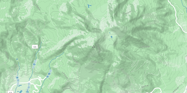
As we enter the autumn season, its nice to go to the Bandai area. Aizu Bandai-san (1819 meter) used to be once taller and shaped like Mt. Fuji, until it blew its top in 1888 and lost its weight and height. The present geography around it is because of this eruption, including the many color lakes, Goshikinuma.
We will depart from Tsukuba (TX station short term parking) at 6 AM to arrive at the trail head by about 9:30 AM. We will climb from Happodai, the shortest route (2 h to climb), so that we have time to visit the lakes in the evening, and possibly an onsen before heading home to Tsukuba.
This will be a car based trip, so participants with cars are especially welcome.
Some other information is as below:
What to bring
-
strong hiking shoes for going up Bandai-san
-
raingear
-
drinking water and lunch
-
warm clothes as it will be cold in the mountains
-
onsen kit
Meeting place and time -
6:00 am on Saturday Oct 13 at the short time parking of the TX station
Costs
- share of transportation (gasoline and highway tolls)
- club fee 300 yen
- onsen
Let me know if you want to join, and if you have a car or not.
I will try to be at the club meeting on next Wednesday Oct 3.
Organiser

Report
Report of the Bandai-san (Fukushima) hiking.
Ten persons in 2 cars started from Tsukuba at about 6:20 AM. We took Joban Expressway to north, changed to Ban-Etsu expressway at Iwaki Junction, passed Koriyama and got off at Inawashiro Bandai Kogen IC. Then headed east and around the Bandai area (on route 115 then 459) to enter Goldline drive from the north (there happened to be no toll booth, so we didn't pay any toll).
We arrived at the Happodai Bandai-san Tozanguchi, the starting point of the climbing (at 1194 m altitude), at about 10:15. The parking was full, and we were directed to another parking back to a lower level, from where we walked back some 500 m to the starting point, used the restrooms, and started walking at about 10:45.
This was high time of autumn colors at this altitude, all along our hiking trail until below the Bandai peak. You can see these lovely colors in our pictures. The weather was nice for this season, a bit cloudy over the mountain to begin with, but cleared up later. The peak continued to be surrounded by fog though. For most part, the trail was muddy and with rocks, and tree roots as additional distraction. At this time most people were already descending, so we had to give way to sometimes 20 people at a time, before proceeding further.
We reached Koubou-shimizu Goya (about 1650 m altitude) at about 12:30. Here the vegetation cleared up and there were great views of the surroundings. We could see vast distances, with a view of lake Hibara. This place has two or three shops where you can also get hot cup ramen (and use a disposable toilet for about 350 yen, which you have to then carry back to a disposable box at the starting point). A little down below was Hana-batake point, near the rim of the vast crater, with stratified geological-layers and lava structures. From here the Bandai peak (1816 m altitude) was a relatively steep slope up ~150 m.
Everybody was back at the starting point before 4:30 PM. We brought our cars here and headed towards Goshiki-numa ponds (which have different colors due to minerals) in the fading daylight past 5 PM. When we arrived there, it was already nearly dark; we hurried to the nearest pond and had a view (and reflection) of Mt. Bandai!
By this time everything had closed down in this tourist area. Eiko found an onsen hotel open for daytime visitors (using her onsen app) near the Inawashiro Bandai Kogen highway IC, and we headed there in dark deserted roads.
http://www.listel-inawashiro.jp/english/
As we arrived, we saw only the tall building from the parking areas, but were otherwise lost in the dark. Eiko and Tatsuya made calls to find the entrance. It was a very nice onsen, on three floor levels. Eiko also got us discount by finding coupons on the web, so we could enter for 700 yen, instead of regular 1,000 yen.
We left the onsen at about 8 PM. We stopped at Abukuma Kogen service area of the highway to get some dinner and settle transportation charges. From there we left for Tsukuba at about 9:00 PM, to arrive in Tsukuba at about 11:30 PM.
I want to thank all the participants for joining the hike and for the great company that made everything so much enjoyable. I particularly thank Rick for driving, and Eiko as well as Tatsuya for finding places in the dark, such as the Goshikinuma pond and the great onsen!
Location